(a UN program which aims to reduce emissions from deforestation and forest degradation, with an added focus on conservation, the enhancement of forest carbon stocks and the sustainable management of forests) and is expected to improve forest and land-use governance, especially in creating a synergised mapping and licensing system.
A synchronised, synergised and widely accepted map of forest and land use in Indonesia — adhered to across all sectors and levels of government — is fundamental to addressing the challenges that face Indonesia’s land-use management.
The recent debate between Greenpeace and the President Susilo Bambang Yudhoyono’s special staff on climate change about the exact figures of deforestation in Indonesia has reaffirmed the importance of having a credible, reliable, accessible and transparent mapping system of forest and land use. Without it, Indonesia cannot measure and account for its greenhouse gas emissions, land-use changes and deforestation. Also importantly, a credible map would help settle land conflicts.
In December 2010, Indonesia’s Corruption Eradication Commission (KPK) found that a synchronised map of forest areas did not exist. Instead, there were at least four different versions that were incompatible with each other. According to the KPK, the lack of a consolidated map, coupled with unclear definitions and boundaries of forest areas and a lack of fair procedures in designating forest areas, has called into question the legitimacy of land use management for 88.2 per cent of forest areas — more than 105.8 million hectares.
Given the variety of sectors and actors that have interests in forest and land use it is challenging to forge a consensus on a map that is acceptable to all.
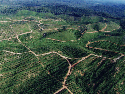
A positive step in this direction is the development and refinement of the moratorium-indicative map (MIM).
The REDD+ taskforce, which has been given a mandate by Indonesia’s president to develop the national REDD+ strategy, is working with different agencies — including the National Coordination Agency for Surveys and Mapping (Bakosurtanal), the forestry and agriculture ministries, the National Land Agency (BPN) and the President’s Delivery Unit for Development Monitoring and Oversight — to develop a common agreed upon MIM. This will help avoid confusion and create legal certainty.
The MIM is required to outline the areas covered in the moratorium and is updated every six months to integrate the latest data from additional agencies and results from site visits.
After the first year, a second MIM has now been made available, although it bears some discrepancies with the first map. In the first MIM, the total moratorium area was 69.1 million hectares, whereas in the second MIM, the total moratorium area was reduced to 65.5 million hectares. The REDD+ taskforce argues that these differences occurred because the first MIM only used the definitions of ‘natural primary forests’ from the forestry ministry and ‘peat-land’ from the National Development Planning Board (Bappenas) and Wetlands International. The taskforce also incorporated areas with ongoing land-use activities covered only by licences issued by the ministry without any field-survey components.
The second MIM, according to the taskforce, covers information provided by different agencies. For example, this map has taken into account the definitions and data relating to peat-lands from the Ministry of Agriculture, licences issued by the BPN and some field studies and research on peat-land nationwide.
Since there are many sectors and actors involved, synchronising the map may add or reduce the relevant figures, depending on which figures the taskforce chooses to incorporate. Negotiations and trade-offs are therefore likely to take place among these sectors and actors.
To obtain a credible map, however, such processes need a level of transparency that will allow the wider public to access the map.
The recent clearing and burning of the Tripa peat-swamp forests for palm oil in Aceh’s Nagan Raya district is a clear example of a ‘small’ but serious discrepancy of forest and land-cover data in the MIM that needs to be urgently addressed. The involvement of civil society in protesting the licence issued for this land, and reporting it to the central government, eventually led to an investigation of this case. These events clearly provide a valuable lesson: to avoid future land conflicts at the local level, improving the MIM’s accuracy needs to be prioritised.
It is also imperative to provide credible and transparent mapping and licensing systems — feeding back to district/provincial land-use policies and regimes — so that land-use management can bring about better social, economic and environmental outcomes.
Fitrian Ardiansyah is a doctoral candidate at the Australian National University, and a recipient of an Australian Leadership Award and an Allison Sudradjat Award.
Thomas Barano is a conservation spatial planning specialist at World Wildlife Fund Indonesia.
This article was originally published here on the Jakarta Post.